
Technology
Perception technology
Rather than inferring the sail's geometry from the position of its controls, Sail Controls measures its real three-dimensional shape, as it exists under wind and mechanical loads.
Where the cloud stops, the model carries on.
No point cloud is ever complete: the mast, the boom and the viewing angle leave areas without measurement. Sail Controls algorithms rebuild them from the shape measured all around, and deliver a whole, consistent sail, usable section by section. That is the difference between a point cloud and a shape measurement.
This real-time approach is essential for sailors and performance teams, as it delivers reliable, immediately usable data to optimise sailing and maximise sail efficiency.
Why use LiDAR
Measure, rather than interpret.
A measurement, not an interpretation. Each laser pulse returns with a distance: every point in the cloud is a measurement, positioned in three dimensions. A photo only gives a flat image; the sail's shape has to be inferred by interpreting differences in colour and contrast, then rebuilt by computation.
The sail, located in space. Every LiDAR point is expressed in the boat's reference frame. You get the sail's shape, but also its position: the angle of each section to the boat's axis, twist, leech opening, mast deformation. A photo is tied to no reference frame: it gives a shape, never a position. It lacks the key information.
No image to correct. Between the sail and the image, the camera puts a lens: distortion, focal length, focus, alignment. These well-known physical deformations must be calibrated and corrected before a single dimension can be read. LiDAR does not go through an image: it measures distance directly.
Its own light. The laser lights what it measures. The measurement depends neither on the sun nor on shadows: it stays the same by day and by night, and in poor visibility.
Underway, this is what captures the shape of your sails in detail, even in strong conditions, with values usable straight away.
Choice of LiDAR
Sail Controls relies on LiDAR sensors specifically suited to sailing, chosen for their high resolution and optimal range for the size of the rig; their number and placement depend on the sails to be measured. Continuous technology monitoring ensures ever greater performance.
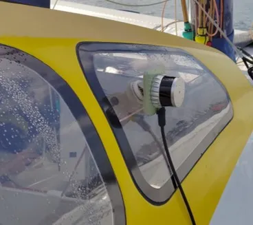
Robustness
Sail Controls selects LiDAR sensors that undergo rigorous quality and reliability testing. Each sensor is validated in varied conditions through a structured design and engineering process. This approach guarantees optimal performance for accurate, reliable measurements underway.
Resolution and efficiency
The LiDAR sensors selected by Sail Controls offer high resolution and a measurement rate suited to the dynamic conditions of sailing, for detailed and fast modelling of the sail.
Sail Controls computer
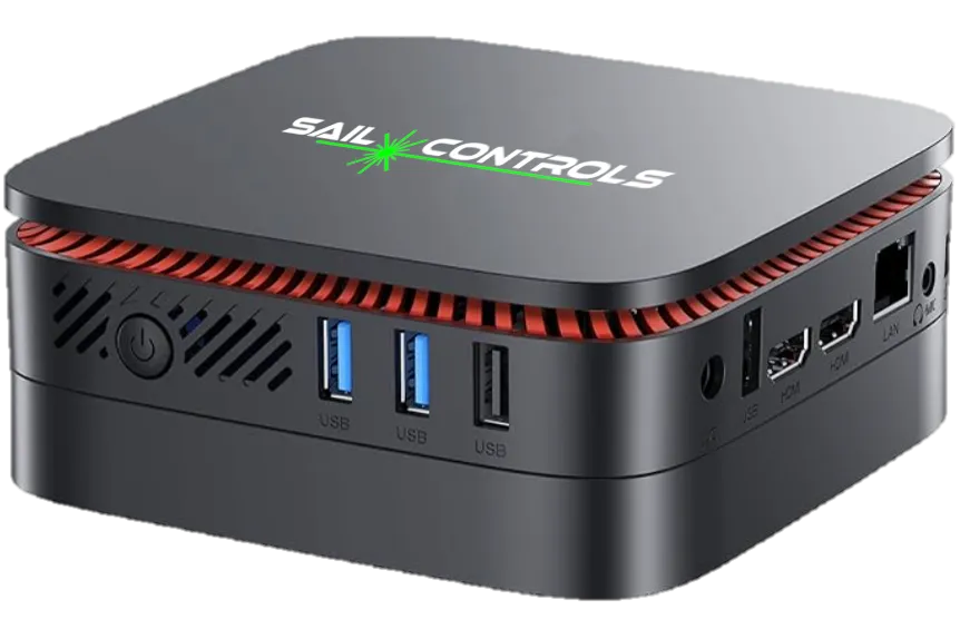
The Sail Controls computer processes the LiDAR stream in real time, extracting only the key data needed to accurately characterise the sail sections underway. Sail Controls sizes it to each user's needs, with one aim: drawing as few resources as possible aboard.
Links & communication
The Sail Controls computer exchanges its data in a protocol compatible with any navigation system. As input, it receives the system's parameters and configurations; as output, it sends its results to the instruments, displays and software already aboard; an API also opens them to your own tools. Integration stays simple, whatever the boat's equipment.
LiDAR
Shape sensor
Computer
Onboard processing
Navigation device
Instruments / display
Real-time information
With cutting-edge technologies such as Sail Controls, sailing enters a new era in which real-time information enriches every aspect of performance. This data makes it possible to record the sail configuration accurately at every key moment, reproduce it in similar conditions and compare performance objectively. By objectifying feel, it provides solid ground for strategic adjustments. Debriefs move into a new dimension: with detailed analysis and reliable measurements, post-sailing discussions become powerful tools to progress, refine trim and better understand the dynamics at sea.
Technical partners

A French company specialising in computer vision and real-time 3D perception, whose expertise helps Sail Controls turn LiDAR measurements into usable information.
perception4d.com
Designer of high-performance autopilots for offshore racing: the sail shape indicators measured by Sail Controls feed directly into its steering algorithms.
madintec.com
Spanish specialist in data analysis for racing yachts (Volvo Ocean Race, America's Cup, SailGP): the sail shapes measured by Sail Controls are natively compatible with its performance analysis tools, synchronised with the boat's own data.
sailingperformance.com
A technical question?
Sensor constraints, integration, deliverable formats: let's discuss your configuration.
Request a meeting